# Tower
#### Control Zone
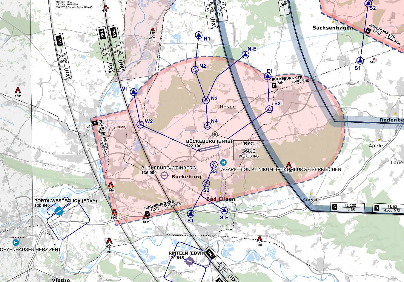
- D(HX) from GND to 2500 ft
- VRPs: November 1/2/3/4, November Echo, Echo 1/2, Whiskey 1/2, Sierra 1/2/3 and Sierra Echo
- Published Local Pattern North of AD (Helicopter at 750 ft MSL, other aircraft at 1250 ft MSL)
- No published Jet Arrivals are available
*CTR Bückeburg - © [openflightmaps.org](https://www.openflightmaps.org/)*
#### Ground Movements
##### Parking Positions
Bückeburg consists of multiple Ramps. Bückeburg Tower should only instruct aircraft to taxi to a Ramp and not to a specific stand.
##### Taxi Instructions
Bückeburg Tower doesn’t need to provide detailed taxi instructions to military traffic if there is no conflicting traffic. Visitors from other squadrons or civilian traffic should receive full taxi instructions.
##### Helicopter Lanes and Pads
Bückeburg is equipped with one Helipad at Ramp 5 and 5 Helicopter Lanes. Helicopter Lanes can be regarded as normal grass runways parallel to runway 07/25 that can only be used by helicopters. Taxi instructions from and to Lane C West or Lane C East must include a runway crossing of 07/25.
#### Departing Traffic
Bückeburg Tower should inform departing traffic about current weather conditions. In the case of military traffic, the colour code is sufficient.
**Bückeburg Tower shall only issue IFR clearances after coordination with EDWW sector Hannover (HAN)!**
**Every IFR departure from ETHB requires a departure release from both ETHB APP and Bremen Radar before issuing a takeoff clearance!**
##### SID-Assignments
- OIDs and SIDs are named after the last two letters of the ICAO code of Bückeburg, ETHB (e.g. HB31)
- Besides SIDs, so-called Operational Instrument Departures (OIDs) are available (HB107 and HB125), initial climb by ATC
| **Via Waypoint/Direction** | **SID Runway 07** | **SID Runway 25** | **Initial Climb** |
| OSN | HB31 | HB11 | 4000 FT |
| To the North\* | HB32 | HB12 | 4000 FT |
| ROBEG | HB33 | HB13 | 5000 FT |
##### Low Visibility Takeoffs (LVTO)
RWY 07/25 is suitable for conducting low visibility takeoffs with a minimum runway visual range of 200m with helicopters.
#### Arriving Traffic
##### Approaches Types
Bückeburg is equipped with an RNAV (GPS) and a PAR approach onto runway 07 and an ILS, an RNAV (GPS) and a PAR approach onto runway 25. There are also NDB approaches available that will lead to the aerodrome, terminating into a circling approach onto both runways.
Bückeburg Radar will maintain Radio contact with aircraft performing a PAR/SRA until landed. Bückeburg Tower should inform Bückeburg Radar if the runway is clear and the aircraft performing the PAR/SRA is cleared to land.