Due to Ramstein being an American airfield, **controllers may use FAA procedures and phraseology** if they are familiar with them, but are not required to do so.
As Ramstein is a military airport, charts can't be found in the normal AIP. They are accessible through the GEMIL FLIP US DoD in the [milais](https://www.milais.org/publications.php "MILAIS Publications"). **Ramstein is an unrestricted airport**. The Ground position can be staffed by all controllers with an **S1** rating or higher. The Tower position can be staffed by all controllers with an **S2** rating or higher. The GCA position can be staffed by all controllers with an **S3** rating or higher. However, controllers should closely familiarize themselves with military procedures before staffing the airport. ### Ramstein ATC Stations| **Station** | **Station ID** | **Login** | **Frequency** | **Remarks** | **Endorsement** |
| **ATIS** | ATAR | ETAR\_ATIS | 127.185 | -- | -- |
| **Ground** | TARG | ETAR\_GND | 121.775 | American procedures, military station | unrestricted: no course |
| **Tower** | TART | ETAR\_TWR | 133.205 | American procedures, military station | unrestricted: no course |
| **GCA** | TARA | ETAR\_APP | 124.280 | American procedures, military station | unrestricted: no course |
When Ramstein GCA is not separately staffed, **pilots shall always be instructed to perform the published missed approach procedure**.
#### Radar pattern The radar pattern is always located North of the airport at an altitude of 4000ft or 5000ft AMSL. This pattern is **only available on explicit pilot request and when Ramstein GCA is separately staffed**. Ramstein Tower shall instruct the pilot to climb out straight ahead to the coordinated pattern altitude and initiate a **handoff to Ramstein GCA no later than 3 NM beyond the departure end** of the runway. Additionally, during 08/09 operations, pilots shall be informed of the minimum climb gradient of 250ft per NM. > **Ramstein Tower**: Clue 1, fly runway heading, climb to 5000ft, climb gradient 250ft per mile, wind 060 degrees, 9 knots, runway 08, cleared for takeoff. > **Clue 1**: Roger, runway heading to 5000ft, runway 26, cleared for takeoff, Clue 1. > **Ramstein Tower**: Clue 1, contact departure. ### VFR traffic #### Departure procedures ##### General Helicopter pilots are required to exit the CTR on one of the **published helicopter routes**, while other traffic has to exit the CTR via the VFR departure pattern. During **08/09 operations**, aircraft shall be instructed to continue on runway heading until passing 1.5 DME RMS and then turn right heading 170 or until passing 3 DME RMS and then turn left heading 360 until clear of the CTR depending on requested departure direction. During **26/27 operations**, aircraft shall be instructed to continue on runway heading until passing 2 DME RMS and then turn right heading 290 or 360 until clear of the CTR depending on requested departure direction. > **Ramstein Tower**: Clue 1, after departure continue on runway heading until passing 3 DME Ramstein, then turn left heading 360, report leaving class D airspace, wind 300 degrees, 4 knots, runway 26, cleared for takeoff. ##### Fighter jet departures Departing fighter jets have to exit the CTR via the VFR departure pattern as well but **shall be instructed to climb to 4000ft or above**. > **Ramstein Tower**: Clue 1, after departure continue on runway heading until passing 2 DME Ramstein, then turn right heading 290, climb to 4000ft or above, report leaving class D airspace, wind 060 degrees, 9 knots, runway 08, cleared for takeoff. #### Arrival procedures ##### General Arriving aircraft are required to contact Ramstein Tower prior to entering the CTR and obtain clearance for entry into the CTR. Helicopter pilots are required to enter the CTR on one of the **published helicopter routes**, while other traffic has to enter the CTR either from a cardinal direction or via the military reporting point. Additionally, all VFR traffic must be at 3000ft AMSL or below when entering the CTR While military entry point and initials are publicly available, **pilots should be expected to not be aware of them** and will most likely request entry via a cardinal direction. ##### Overhead approach Aircraft entering via PIVOT for an **overhead approach** will continue to WISKY or ECHO and shall be instructed to report WISKY/ECHO at 3000ft. The break-off always has to be right-hand at 2500ft. If necessary, Tower shall sequence traffic by instructing early or late breaks. > **Clue 1**: Clue 1, overhead PIVOT, 3000ft, for overhead pattern. **Ramstein Tower**: Clue 1, roger, report ECHO at 3000ft. > **Clue 1**: Wilco, Clue 1. > **Clue 1**: ECHO, 3000ft, Clue 1. > **Ramstein Tower**: Clue 1, break to the right at 2500ft, report base with intentions. > **Clue 1**: Breaking to the right at 2500ft, wilco, Clue 1. > **Clue 1**: Base, gear down, for full stop, Clue 1. > **Ramstein Tower**: Clue 1, wind 300 degrees, 4 knots, runway 26, cleared to land. > **Clue 1**: Runway 26, cleared to land, Clue 1.Controllers are reminded that during an overhead approach, aircraft, especially fighter jets, will **fly at high speeds of up to 300 KIAS** until breaking off.
##### High speed downwind The high speed downwind is **only available on pilot request**. Pilots will enter via PIVOT and then proceed to WISKY (26/27 operations) or ECHO (08/09 operations) to cross both points at 3000ft and join the downwind from there. During 08/09 operations, only the Southern high speed downwind is available. When passing ECHO, pilots shall be instructed to turn to a suggested heading of 240 and descend to 2000ft to enter a right hand downwind. During 26/27 operations, aircraft entering the Northern high speed downwind shall be instructed to join a right hand downwind from WISKY and descend to 2000ft; aircraft entering the Southern high speed downwind shall be instructed to turn to a suggested heading of 110 and descend to 2000ft to enter a left hand downwind. > **Clue 1**: Clue 1, overhead PIVOT, 3000ft, for high speed downwind. **Ramstein Tower**: Clue 1, roger, report WISKY at 3000ft. > **Clue 1**: Wilco, Clue 1. > **Clue 1**: WISKY, 3000ft, Clue 1. > **Ramstein Tower**: Clue 1, turn left to suggested heading 110 to join downwind runway 26, descend to 2000ft, report base with intentions. > **Clue 1**: Heading 110 to join downwind runway 26, descending to 2000ft, wilco, Clue 1. > **Clue 1**: Base, gear down, for full stop, Clue 1. > **Ramstein Tower**: Clue 1, wind 300 degrees, 4 knots, runway 26, cleared to land. > **Clue 1**: Runway 26, cleared to land, Clue 1. #### Traffic pattern ##### Closed inside traffic pattern The standard inside traffic pattern, which is contained within the CTR, is always located North of the airport with a maximum altitude of 2000ft AMSL. Ramstein Tower shall always inform pilots of these restriction. Additionally, the inside pattern is **only available during 26/27 operations**. > **Ramstein Tower**: Clue 1, join right hand inside pattern runway 08, not above 2000ft, wind 060 degrees, 9 knots, runway 08, cleared for takeoff. ##### Closed outside traffic pattern The standard outside traffic pattern, during which the aircraft shortly leave the CTR, is always located North of the airport with a maximum altitude of 3000ft AMSL. Additionally, pilots in the outside pattern are required to route WISKY PIVOT ECHO during 08/09 operations and ECHO PIVOT WISKY during 26/27 operations. Ramstein Tower shall always inform pilots of these restriction and may **only use this pattern on explicit pilot request**. As this is the only pattern available during 08/09 operations, pilots requesting VFR patterns should be pointed towards the appropriate documentation for the outside pattern or, if Ramstein GCA is online, be recommended to opt for the radar pattern. > **Clue 1**: Ramstein Tower, Clue 1, at Golf South, request outside pattern, ready for departure. **Ramstein Tower**: Clue 1, join right hand outside pattern runway 08 via WISKY, PIVOT, and ECHO, at 3000ft, wind 060 degrees, 9 knots, runway 08, cleared for takeoff. #### Helicopter procedures Helicopters at Ramstein may be cleared for take-off and landing on either runway as well as any taxiway. Departure from or landing on the ramps is not possible. ##### Helicopter routes Helicopters can enter and exit the CTR via reporting points Olsbrucken, Glan Münchweiler, Miesau, and Linden. Ramstein Tower will instruct pilots depart/approach the airport via Mackenbach, Landstuhl West, or Kindsbach. The airport connection points and CTR entry/exit points shall be connected through the published routes. ##### Landstuhl Heliport (ETIP) Helicopters operating locally at Landstuhl Heliport at or below 100ft AGL (ca. 1200ft AMSL) are not required to contact Ramstein Tower. Departing traffic has to contact Ramstein Tower prior to departure for clearance to enter the CTR; however, their takeoff is on own discretion and they shall thus not be given a takeoff clearance. Likewise, arriving traffic shall not be given a landing clearance. ##### Landstuhl Hospital Helicopters operating locally at Landstuhl Hospital at or below 100ft AGL (ca. 1200ft AMSL) are not required to contact Ramstein Tower. Departing traffic has to contact Ramstein Tower prior to departure for clearance to enter the CTR; however, their takeoff is on own discretion and they shall thus not be given a takeoff clearance. After departure, helicopters shall be instructed to proceed to Landstuhl West and then to leave the CTR along the published helicopter routes Arriving traffic shall not be given a landing clearance as landings are on own discretion. When arriving from the North, these helicopters shall be routed to Landstuhl West and from there follow Autobahn 62 at or above 500ft AGL toward the hospital; when arriving from the South, they may enter the CTR along Autobahn 62 at or above 500ft AGL toward the hospital. > **Medevac 86**: Ramstein Tower, Medevac 86. > **Ramstein Tower**: Medevac 86, Ramstein Tower, go ahead. > **Medevac 86**: Medevac 86, 2 minutes North of Olsbrucken, destination Landstuhl Hospital. > **Ramstein Tower**: Medevac 86, enter class D via Olsbrucken, Mackenbach, Miesenbach, Landstuhl West, thereafter follow Autobahn 62 to Landstuhl hospital, not below 500ft AGL. > **Medevac 86**: Enter via Olsbrucken, Mackenbach, Miesenbach, Landstuhl, and Autobahn 62, not below 500ft AGL, Medevac 86. #### Reporting points There are thirteen reporting points around the Ramstein CTR, some of which are non-compulsory reporting points.| **Reporting point** | **Location** | **Remark** |
| **Olsbrucken** | Olsbrücken village | helicopters only CTR entry from/exit to the North |
| **Glan Münchweiler** | Glan-Münchweiler village | helicopters only CTR entry from/exit to the West |
| **Mackenbach** | Mackenbach village | helicopters only non-compulsory reporting point |
| **Miesenbach** | Miesenbach village | helicopters only non-compulsory reporting point |
| **Landstuhl West** | highway intersection A6 and A62 | helicopters only non-compulsory reporting point |
| **Kindsbach** | Kindsbach village | helicopters only non-compulsory reporting point |
| **Miesau** | Miesau village | helicopters only CTR entry from/exit to the West |
| **Hauptstuhl** | Hauptstuhl village | helicopters only non-compulsory reporting point |
| **Hohenecken Lake** | Gelterswoog lake | helicopters only |
| **Linden** | Linden village | helicopters only CTR entry from/exit to the South and East |
| **PIVOT** | Jettenbach quarry | fixed wing only military reporting point CTR entry/exit |
| **WISKY** | intersection B423 and A62 | fixed wing only military reporting point |
| **ECHO** | intersection L367 and B270 | fixed wing only military reporting point |
Ramstein GCA shall **always inform the controller of EDGG sectors Pfalz and Neckar Low** when opening and closing the position.
### Airspace The airspace controlled by Ramstein GCA is class E which is lowered to 1000ft AGL in the majority of the area of responsibility with a small section of class E lowered to 1700ft AGL in the West. [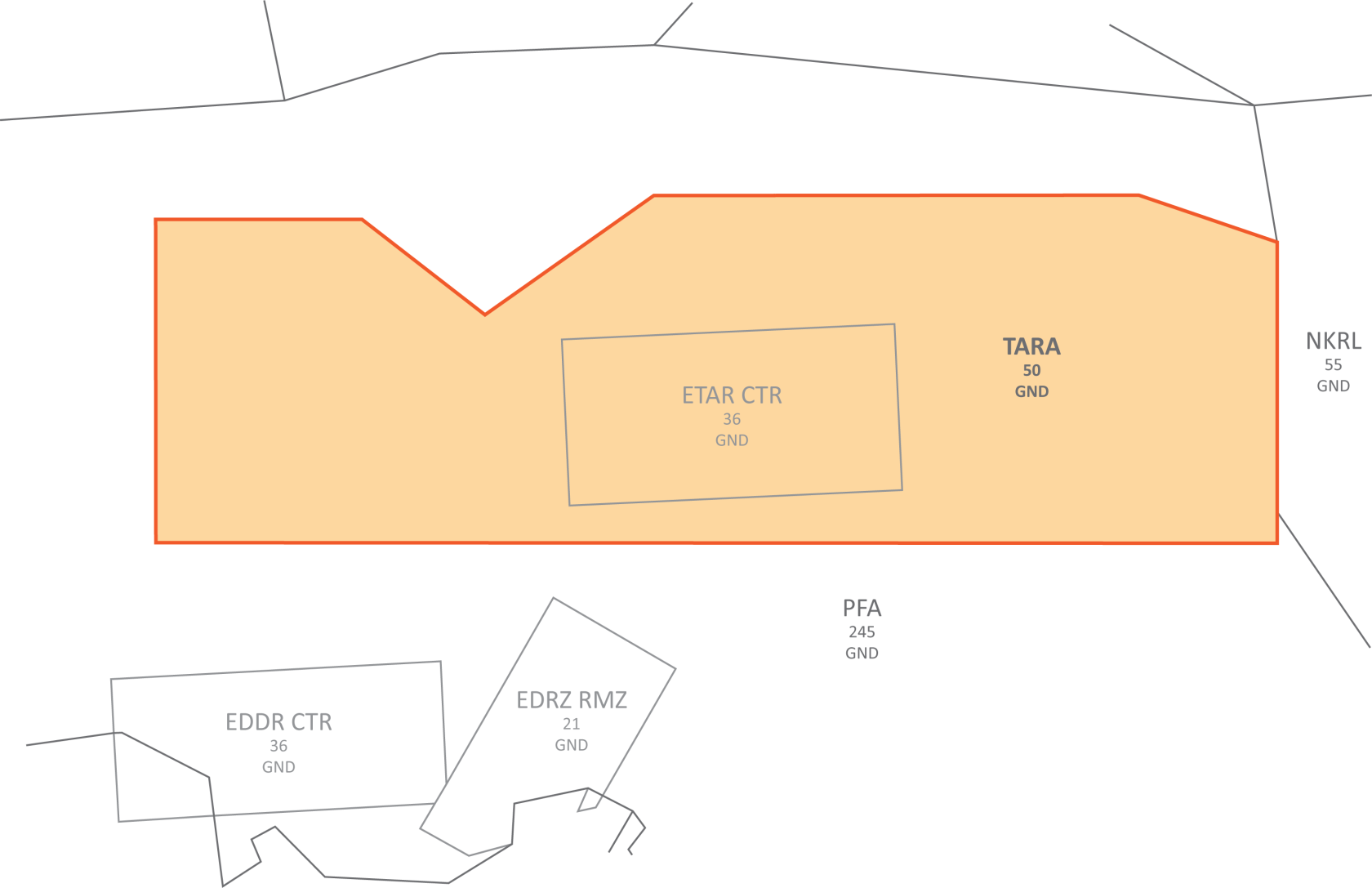](https://knowledgebase.vatsim-germany.org/uploads/images/gallery/2024-04/etar.png) ##### Airspace boundary Ramstein GCA may use the entire sector up until the border except for the border with Langen Radar sector Neckar Low to which half lateral separation shall be kept. Langen Radar sector Pfalz is responsible for maintaining full lateral and vertical separation to the sector border. ##### EDDR/EDRZ departures EDDR and EDRZ departures via TOMPI which climb at a very low rate may not clear the Ramstein approach sector. In these cases, Langen Radar will request an airspace crossing which shall be approved as soon as possible. ##### EDRZ arrivals During 21 operations at EDRZ, all IFR approaches will have to cross the Ramstein approach sector. In these cases, Langen Radar will request an airspace crossing which shall be approved as soon as possible. ### Departure procedures ##### Departure release When Ramstein Tower requests a departure release for an aircraft that will not remain in the local pattern, Ramstein GCA has to **obtain a further departure release for this aircraft from Langen Radar**. ##### Transfer to civilian ATC Handoffs for departures shall always take place **before the sector boundary or before reaching BOLKI or TOLEY**, whichever is earlier. ### Arrival procedures ##### Transfer from civilian ATC Handoffs for arrivals shall always be **coordinated individually** and then take place as agreed. Ramstein GCA should, whenever possible, approach civilian ATC with a proposal for the handoff ahead of time, but **usually a DCT to XIDOD** (26/27 operations)**, MAPIG** (08/09 operations)**, or RMS** (either direction) **at 5000ft with a full release is the best solution**. ### Radar pattern The radar pattern is always located North of the airport at an altitude of 4000ft or 5000ft AMSL and will be conducted entirely through radar vectors. This pattern is **only available on explicit pilot request and when Ramstein GCA is separately staffed**. Ramstein Tower will instruct the pilot to climb out straight ahead to the coordinated pattern altitude and initiate a handoff to Ramstein GCA within 3 NM of the departure end of the runway. Ramstein Ground will request approval for a radar pattern clearance from Ramstein GCA. During this coordination, Ramstein GCA shall assign the pattern altitude.