Minimum Separation Tool and QDM
Minimum Separation Tool
The minimum separation tool displays the predicted minimum lateral separation between two radar tracks within the next 30 minutes, assuming both of them maintain their present ground tracks and speeds. The minimum separation tool can be used both laterally as well as vertically.
The minimum separation tool complements the MTCD system as the controller can evaluate the situation more precisely and therefore can decide whether action needs to be taken or not.
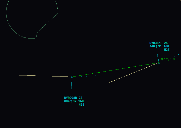
The minimum separation tool can be activated by pressing ALT + S and then left-clicking on both aircraft's labels. Once this is done, a SEP list window will open, showing the selected aircraft pair, the minimum distance calculated at the Closest Point of Approach (CPA) and the time to the CPA. Additionally, two lines will be displayed showing the distance and track to the CPA.
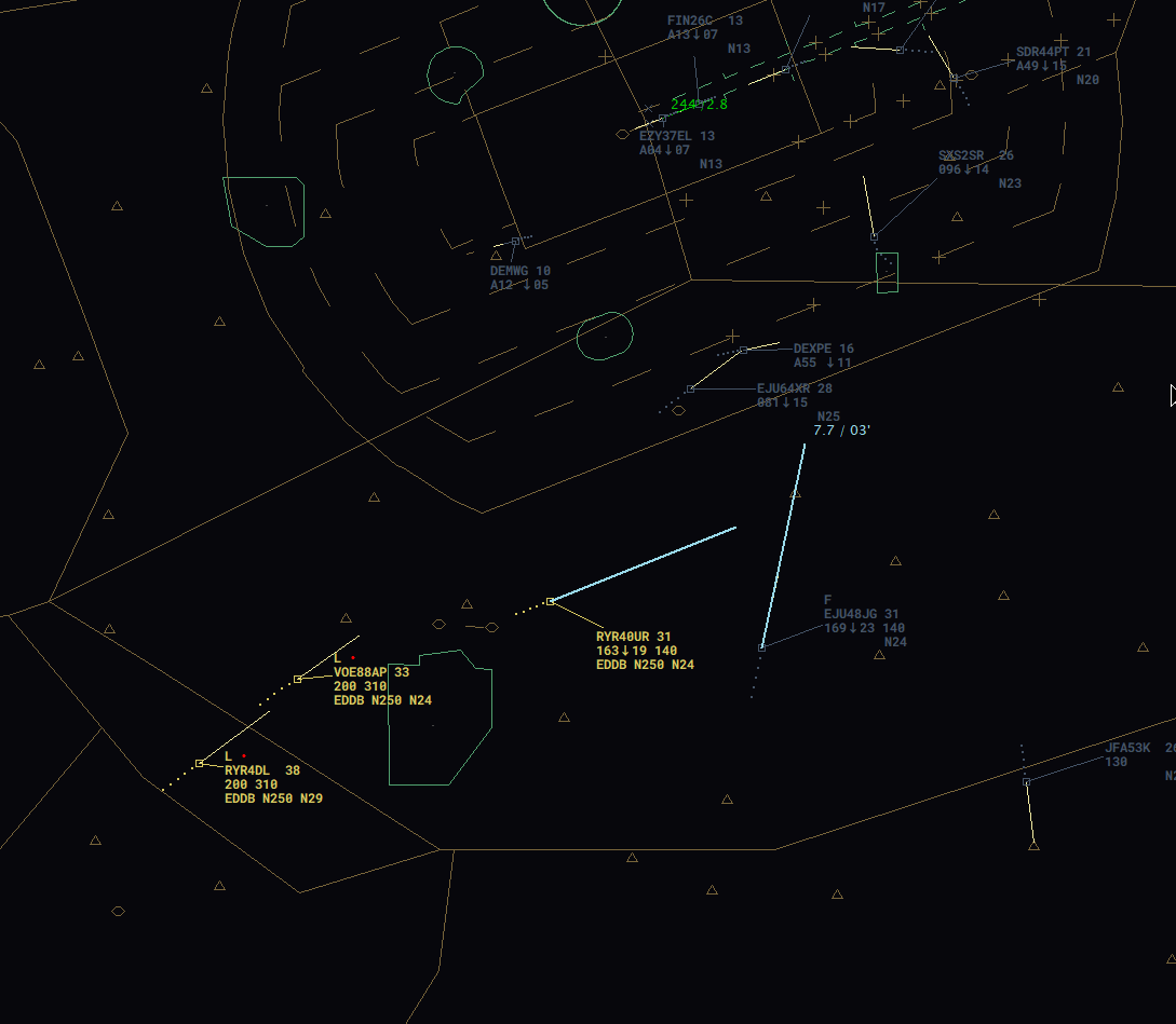 In this example, EJU48JG and RYR40UR will meet closest in 3 minutes with a lateral separation of 7,7 NM.
Besides between lateral movements shown in the example above, the minimum separation tool can also be used for vertical movements. Here, the vertical minimum separation tool comes into play. This tool can be activated by left-clicking on the colored box of the SEP List window.

Furthermore, some dots will appear on the lines. These will indicate the lateral distances between both aircraft once the vertical separation is no longer ensured (less than 1000 ft).
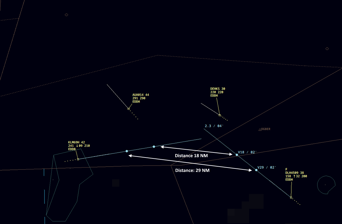
In the example below, the lateral min. separation will be 2.3 NM (which will be reached in 4 minutes). As the KLM is descending and the DLH is climbing, there is a good opportunity that the conflict can be solved vertically. Therefore, we want to know if the current climb/descent rate is sufficient for a safe clearance.
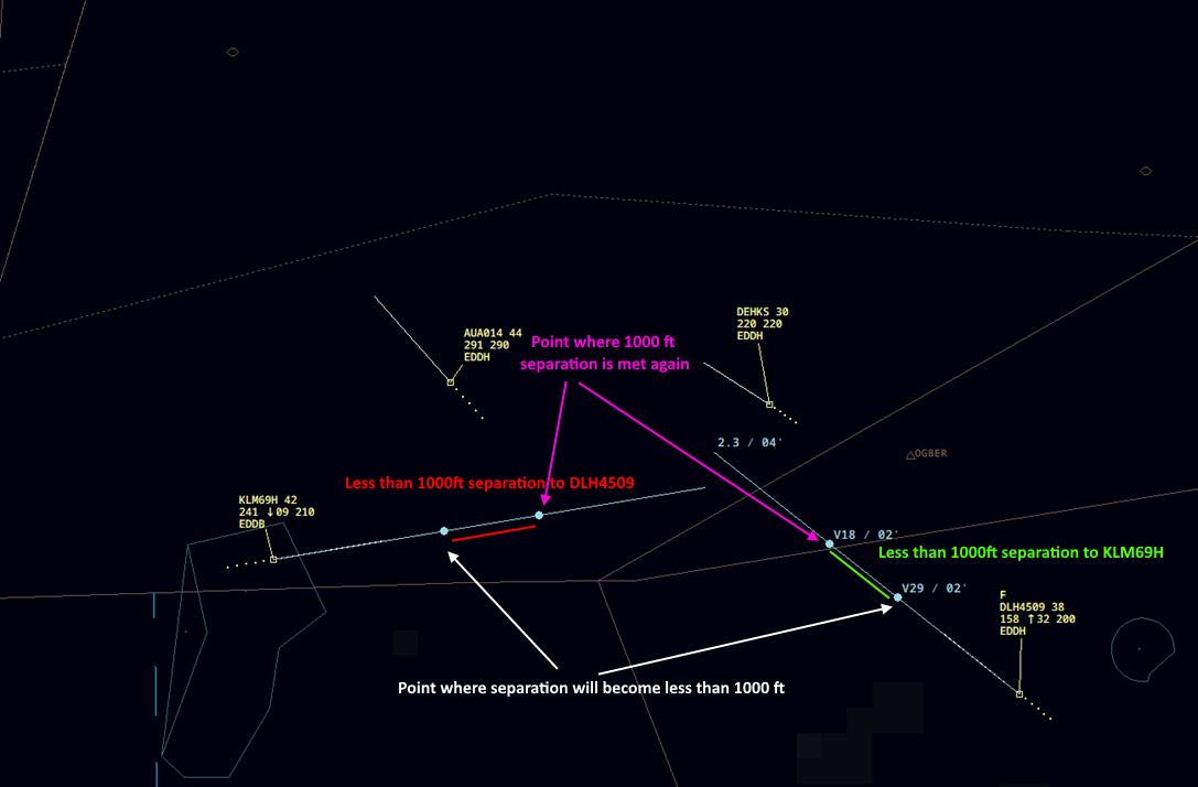
The points shown will indicate the lateral distance between both aircraft at the point where vertical separation will be lost and regained. In this case, KLM69H and DLH4509 will have a vertical separation of 29 NM once they both reach a level where the separation will be less than 1000 ft between both aircraft. As both aircraft will continue climbing/descending, there will be a second dot on each line. In our example, both aircraft will have a lateral distance from each other of 18NM once they both reach a level where 1000 ft vertical separation is met again.
Therefore, we can conclude that the current descent and climb rates are good enough to maintain separation at all times, as the lateral separation in this movement will never be less than required.
Still, as vertical descent/climb rates can vary all the time, the controller needs to instruct assigned rates until both aircraft have crossed vertically. This situation can result in an unsafe clearance if no rates are assigned.
QDM
The QDM tool is a line that connects two points on the radar display and provides information about the distance and the bearing between them. The controller activates the QDM manually by pressing ALT + Q and clicking the points of interest, which may be a point on the screen, a waypoint or navaid or an aircraft track. A QDM can be deleted again by right-clicking on the line. Alternatively, all QDMs on the radar screen can be deleted by pressing ALT + X.
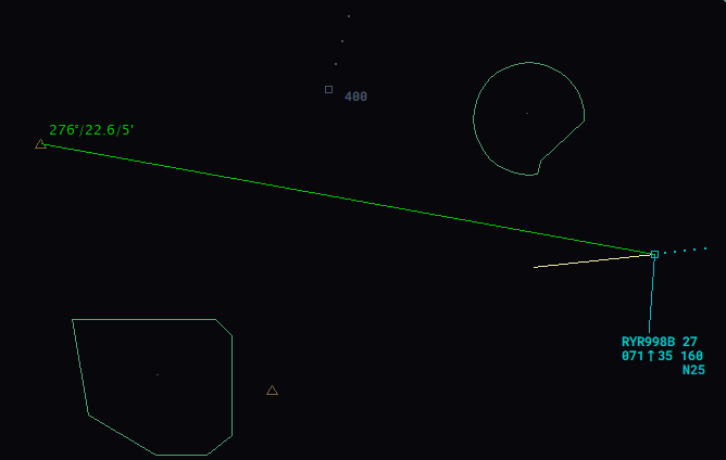 This picture shows a QDM line connected between an aircraft and a waypoint. The QDM is showing the bearing and distance to the waypoint as well as the time at which the aircraft will reach the waypoint based on the current ground speed.
 The picture shows a QDM line connected between two aircraft. The QDM is showing the distance and bearing between both aircraft.
Furthermore, the controller can also use a so-called multi-QDM connecting multiple aircraft to the same waypoint. The advantage of the multi-QDM vectors is that when hovering over a track label of one of the tracks, a relative distance indication is added to the labels of all other vectors belonging to the same multi-QDM group, showing in parentheses the difference in the distance value compared to the selected track.
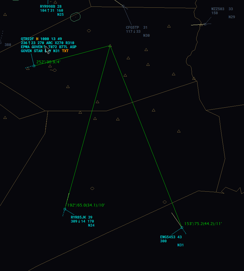 The picture shows a multi-QDM of all three aircraft to a waypoint. Besides the usual information, the relative is shown.