Tower
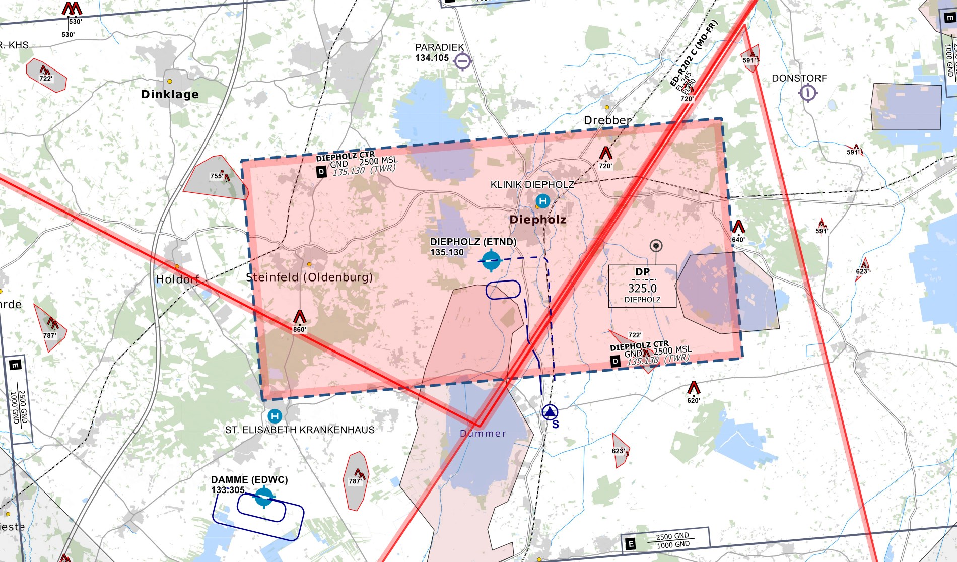
Control Zone
- D(HX) from GND to 2500 ft
- VRPs: Sierra in the south of the CTR (leaving via S only from RWY 08)
- Traffic circuits are only allowed south of the runway
- No published Jet Arrivals are available
 CTR Diepholz - © openflightmaps.org
Ground Movements
Parking Positions
Diepholz consists of multiple military ramps. The ramps north of the runway are primarily used for military traffic. Civil aviation traffic shall use the apron south of runway 26's threshold.
Taxi Instructions
Diepholz Tower shall not provide detailed taxi instructions. Traffic will only be instructed to hold short of the runway and to report ready for departure.
Helicopter Lanes and Pads
Diepholz is equipped with two Helipads on the taxiway north of the runway and one Helicopter Lane. The Helicopter Lane can be regarded as normal grass runways parallel to runway 08/26 that can only be used by helicopters.
Departing Traffic
Diepholz Tower should inform departing traffic about current weather conditions. In the case of military traffic, the colour code is sufficient.
Diepholz Tower shall only issue IFR clearances after coordination with EDWW sector Ems (EMS)!
Every IFR departure from ETND requires a departure release from Bremen Radar before issuing a takeoff clearance!
SID-Assignments
- Only Operational Instrument Departures (OIDs) are available (ND108 and ND126), initial climb by ATC
Arriving Traffic
Approaches Types
Diepholz is equipped with an RNAV (GPS) approach onto runway 08 and an NDB and a COPTER NDB approach onto runway 26. SRA and PAR approaches are not available at ETND.
